Geographic maps have been one of the most basic travel documents since time immemorial. In ancient times, even dangerous expeditions were made to draw up accurate maps. And even in our time, it is far from uncommon to meet a tourist with a huge expanded map.
However, the development of information technology, space exploration and the miniaturization of electronic devices have made it possible to create a special smart service for travelers – electronic maps. In addition to high accuracy, electronic maps in smartphones and computers allow tourists to determine and share their location, find nearby hotels and attractions, save the chronology of trips, and much more. That is why the development of smart tourism is unthinkable without electronic maps.
There are several similar services around the world, but we will take Google Maps as an example, because it has been the most popular navigation assistant for many years. Basically, the advantage of this resource is data volumes surpassing the competitors. This allows you to create more accurate routes, which means saving time. Moreover, Google Maps not only helps to get from one location to another, but also offers its users many additional features, which we will discuss in this article. These features can be useful on any trip as they save a traveler’s time and energy. Another undoubted advantage of this application is being presented not only in the form of a traditional map, but also in the form of satellite photographs, which makes it possible to see the real picture of the area from different heights. In this case, the application interacts with the Google Earth project.
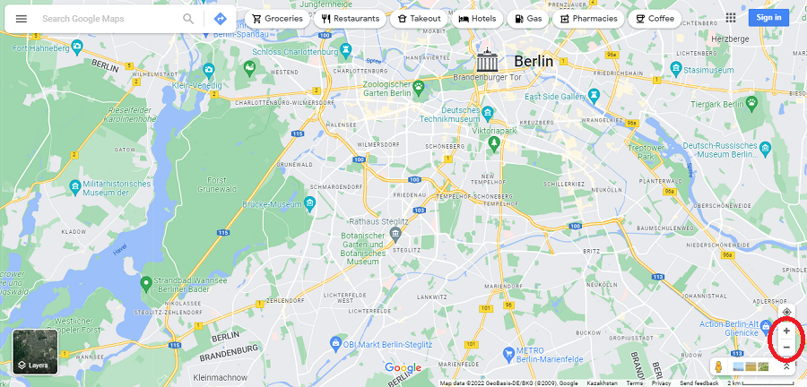
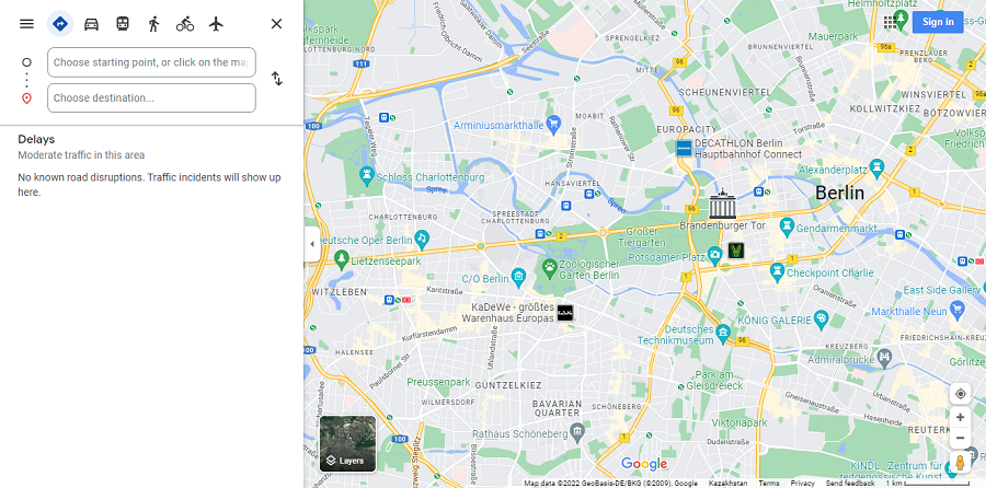
First, let’s get acquainted with the desktop version of Google Maps, and then we’ll talk about the mobile application. It is not much different from the desktop version, but learning is easier on the big screen. To do this, in the search bar of any browser, type “Google maps” and go to the first site found. The map can be moved in any direction by pressing and holding the left mouse button. You can zoom in or out by scrolling the mouse wheel or by changing the zoom in the lower right corner of the map.
 |
Search
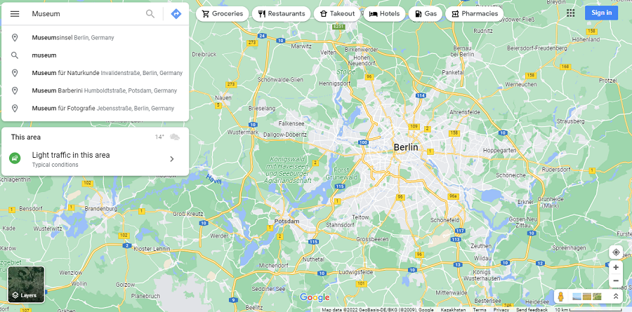
There is a search box in the upper left corner of the map. As soon as you start entering the name of the area, you will be offered options from which you need to select the one you need. After that, a map of the selected area will open. Also with the help of a search engine, you can find objects located in this area. It can be organizations, buildings, museums, monuments and much more. You need to enter the name or address in the search bar. The program will offer options from which to choose.
 |
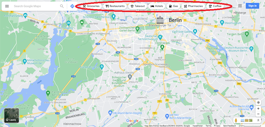
To the right of the search bar, the map prompts you to select a specific category to search for:
 |
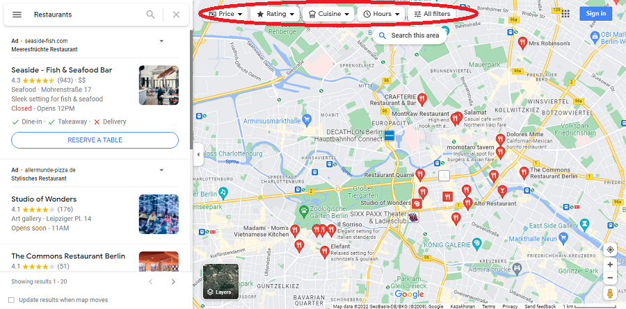
By selecting one of the categories, you can filter the list by rating or other criteria.
 |
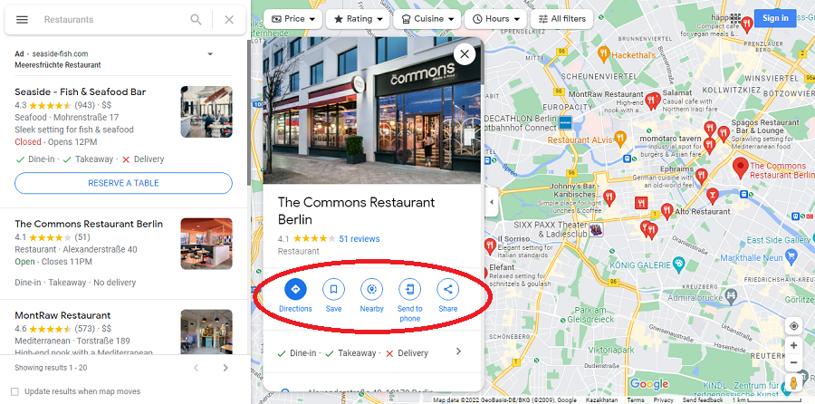
After selecting a specific object from the list or clicking on its mark on the map, a card for this object will open in an additional window. Here you can find a lot of useful information: address, contact numbers, working hours, workload schedule, photos, links, etc. Also many hotels and restaurants offer to book a room or a table right here. And what is very important, you can find reviews of other users who visited this object. It is from these reviews that the rating is formed.
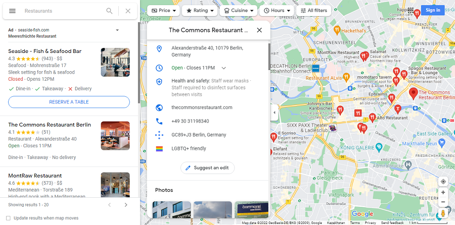 |
It is also possible to save the object in the list of favorites, see what is nearby, send the location data of the object to your smartphone or share it with friends.
 |
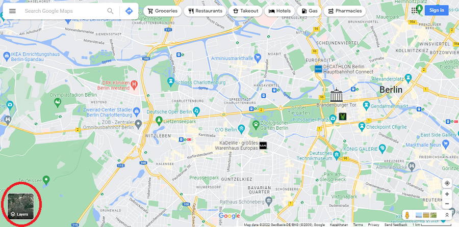
Layers
Let’s move to the lower left corner of the map.
 |
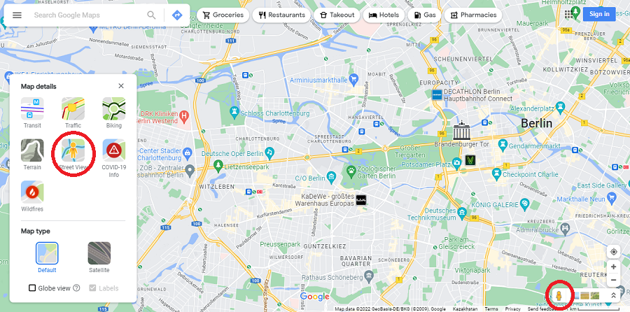
If you move the cursor over the Layers icon, you will see the icons of additional map layers that can be turned on and off individually. First of all, you can choose between a standard map and satellite photos. If you press More, you can see all the options. These are public transport routes, traffic on the roads, bike paths, terrain on the map, viewing photos of streets, information about Covid in the area and forest fires. To turn on a particular layer, just click on it. Only the Street View layer requires an additional action. Having activated this layer, you need to drag the yellow man image from the lower right corner to the point on the map that you would like to view in the panoramic image. You can also disable layers by clicking on their icons.
 |
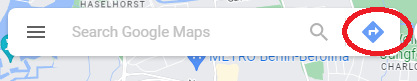
Routes
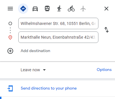
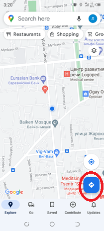
In order to build a route in Google Maps, you need to click on the blue rhombus with an arrow to the right of the search bar.
 |
Instead of a search bar, there will be a bar for entering the start and end points of the route. You can enter the names of points using the keyboard, or you can simply left-click on the desired location on the map. Then you need to choose a mode of transportation by clicking on the desired image in the upper left corner of the screen.
 |
Below you can add waypoints in the same way and then swap them around by dragging and dropping them. Once you have created a route, you can send it to your smartphone.
 |
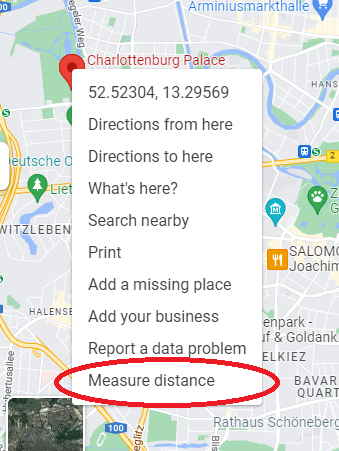
Distance
You can also measure the distance between two points on the map. To do this, select a point by clicking on it, and then press the right mouse button. At the end of the drop-down list, select Measure Distance, and then click on the second point.
 |
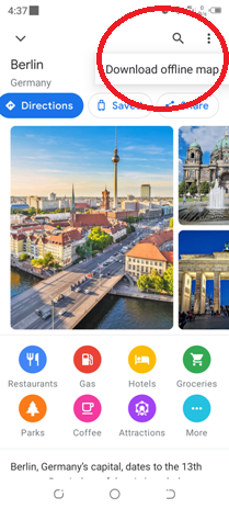
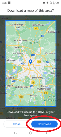
Mobile app
Now let’s move on to the mobile version of Google Maps. You can download it for free in Google Play or App store. Some Android smartphones may already have Google Maps pre-installed. Using the application on your smartphone is very convenient when you travel.
Control
Holding the map with your finger, you can move it in any direction. And by clicking your finger on the map 2 times and holding, you can change the scale of the map with one finger by moving up or down. You can do this with two fingers, spreading and bringing them together. The rest of the controls are almost the same as on the computer, but located in different places.
Instead of clicking with the left mouse button, you need to click on the screen with your finger in the right place. Instead of pressing the right mouse button, you need to hold your finger on the screen until an additional window opens.
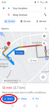
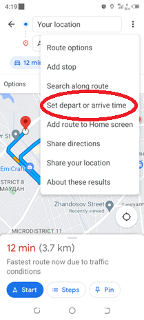
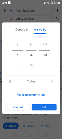
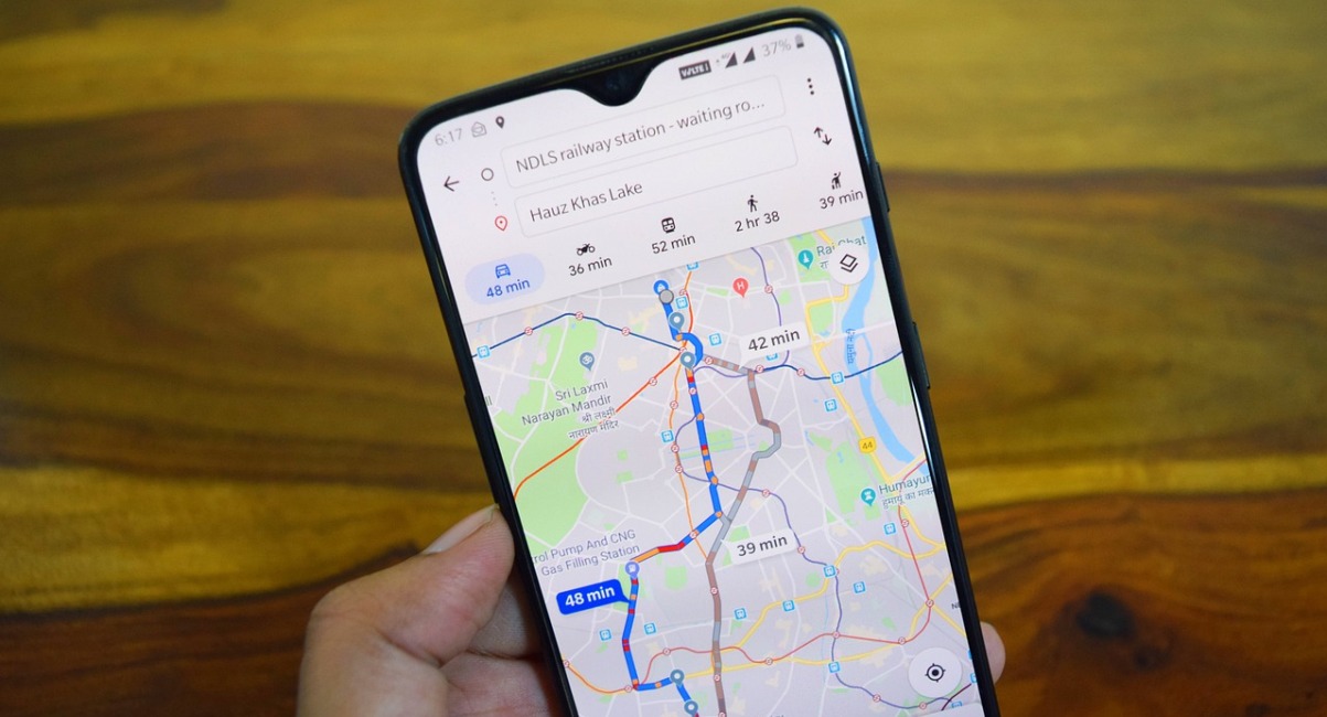
Routes and navigation
Using the same rhombus with an arrow, you can build a route in a way you already know. By clicking on the icon next to it, you can accurately determine your location on the map.
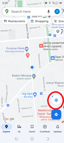
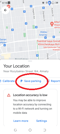
Of course, geolocation must be enabled on the smartphone. ![]()
Having built a route, you can click on the Start icon and your smartphone will turn into a navigator that will tell you the direction of movement along this route.
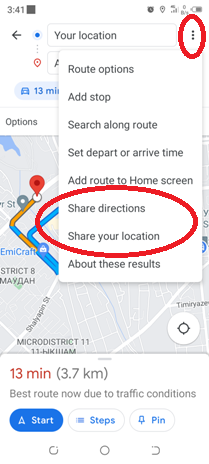
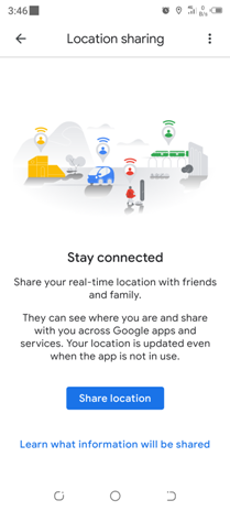
You can share with your friends not only the geodata of some point on the map, but also your location, as well as the route that you have laid. To do this, click on the 3 dots in the upper right corner of the display, and then select the desired function.